1
/
of
5
The Unique Maps Co.
Old World Map from 1671 by Richard Blome - First English World Atlas Wall Chart
Old World Map from 1671 by Richard Blome - First English World Atlas Wall Chart
Regular price
$34.20 USD
Regular price
$45.00 USD
Sale price
$34.20 USD
Shipping calculated at checkout.
Quantity
Couldn't load pickup availability
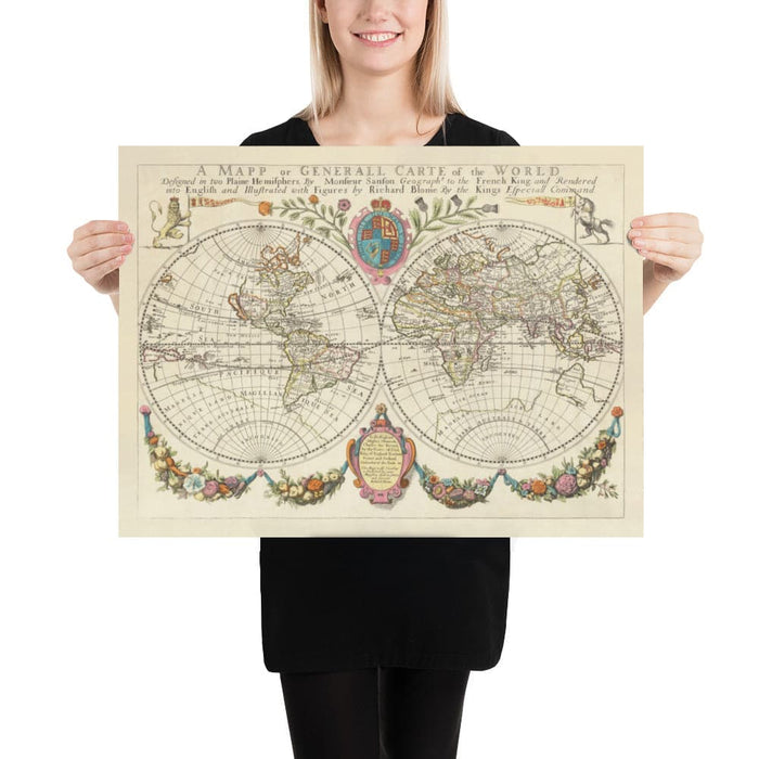
This is one of the earliest and finest large world maps created and printed in England, with everything written in English. The map was published in 1671 by Richard Blome as part of an atlas - also the first that had been engraved and printed in England.
Back in 1671, our understanding of the world wasn't quite what it is today. California is an island! And there's no Antarctica. There is an early outline of Australia, however!
Take a closer look at North America and there are some very early settlements on there. But where is western Canada and Alaska above California...?
Most world maps from this era are in the 'Dutch style' with heavy embellishments around the maps. Blome's map is a little more sparse... and well, a bit more British.
This map looks amazing at all sizes, from 12x16 inches (30x40cm) to 16x20 inches (40x50cm), 18x24 inches (45x60cm) and beyond to 24x36 inches (60x90cm). I can print it and frame it at sizes up to 100 inches wide (250cm). It looks truly beautiful at that larger size, as you can imagine.
This world map would make a perfect gift for someone who loves to travel or explore, or it would look great as wall art on your own walls! It's a beautiful piece of wall art that would make a good housewarming gift.
You can order the map itself, or you can order a framed version. The frame is a nice, simple black frame that really makes our maps pop out when on a wall. Please get in touch if you'd like a different frame. We use super-clear acrylic (perspex/acrylite) in our frames - it's less reflective than glass and better for transport.
Share