The Unique Maps Co.
Old Map of Texas 1856 by Colton - Houston, San Antonio, Dallas, Austin, Fort Worth, El Paso
Old Map of Texas 1856 by Colton - Houston, San Antonio, Dallas, Austin, Fort Worth, El Paso
Couldn't load pickup availability
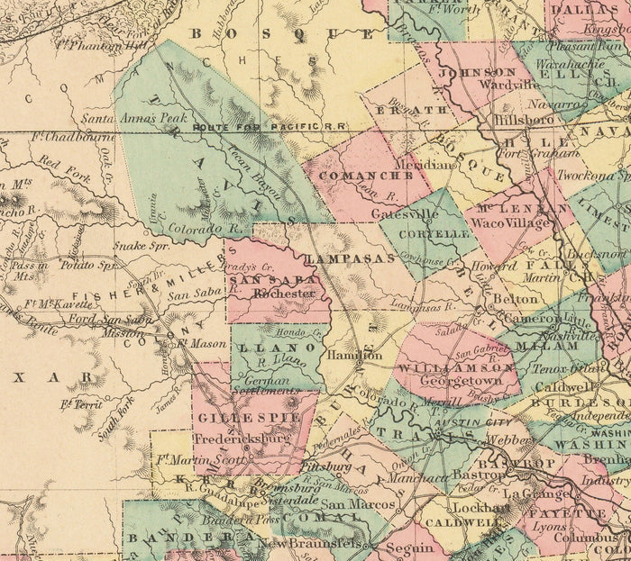
This map of Texas was created and published in 1856 by J. H. Colton, one of the 19th century's top mapmaking firms.
This is an extremely high quality US state map with a huge amount of detail. By the mid-1800s, most of Texas's modern counties had already been incorporated and their borders defined - though you'll notice that many of the borders have changed significantly over the last 150 years.
This map shows railroads, roads, canals, cities, county towns, lakes, villages and even forts (the Civil War was only a few years away, after all!)
In the mid-1800s, the US was very sparsely populated indeed. There are a few big cities that you'll recognise - but many villages and towns haven't yet been founded.
Houston, San Antonio, Dallas, Fort Worth and El Paso are all here - then some of the biggest cities in Texas, just as they are today.
This map looks great at all sizes from 12x16 inches (30x40cm), to 16x20 inches (40x50cm) and 18x24 inches (45x60cm). But it looks even better when printed large. I can create beautiful, large prints of this map up to 70 inches (175cm) wide. Please get in touch if you're looking for larger, customised or different framing options.
The model in the listing images is holding the 20x16 inch (50x40cm) version of this map.
Please note that the 24x30 inch unframed map has white strips along the edge. These can be snipped off easily, or they may help you with framing. All other sizes, and all framed maps, look just like the listing images.
Zoom into the listing images and see if you can spot your hometown... or at least where your hometown will be built!
This map would make a great birthday or Christmas gift for someone from Texas or who has the south central US in their heart.
You can order the map itself, or you can order a framed version. The frame is a nice, simple black frame that really makes our maps pop out when on a wall. Please get in touch if you'd like a different frame, or if you'd like to frame one of the larger maps. We use super-clear acrylic (perspex/acrylite) in our frames - it's less reflective than glass and better for transport.
Share