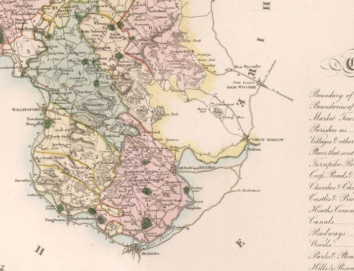
This old, full colour and wonderful map shows the county of Oxfordshire as it was in 1829. Published in Greenwood's Atlas of England & Wales and engraved by J & C Walker, this is one of the finest old county maps from the 1800s.
I can create beautiful, large prints of this map up to 70 inches wide (175cm). Please get in touch if you're looking for larger, customised or different framing options.
In the bottom left corner is a beautiful engraving of Oxford Cathedral.
Some of the towns, villages and places clearly visible in this old map of Oxfordshire include: Banbury, Chipping Norton, Kidlington, Abingdon, Witney, Didcot, Wallingford, Thame, Bicester, Henley and Reading.
Take a look at the detailed images and try to spot your hometown!
This would make a wonderful gift for someone from Oxford, who went to Oxford university, or who has Oxfordshire in their heart.
You can order the map itself, or you can order a framed version. The frame is a nice, simple black frame that really makes our maps pop out when on a wall. Please get in touch if you'd like a different frame. We use super-clear acrylic (perspex/acrylite) in our frames - it's less reflective than glass and better for transport.