1
/
of
5
The Unique Maps Co.
Old Map of North America, 1720 by Herman Moll - USA, Canada, Mexico - French, Spanish & English Colonial Atlas
Old Map of North America, 1720 by Herman Moll - USA, Canada, Mexico - French, Spanish & English Colonial Atlas
Regular price
$31.05 USD
Regular price
$45.00 USD
Sale price
$31.05 USD
Shipping calculated at checkout.
Quantity
Couldn't load pickup availability
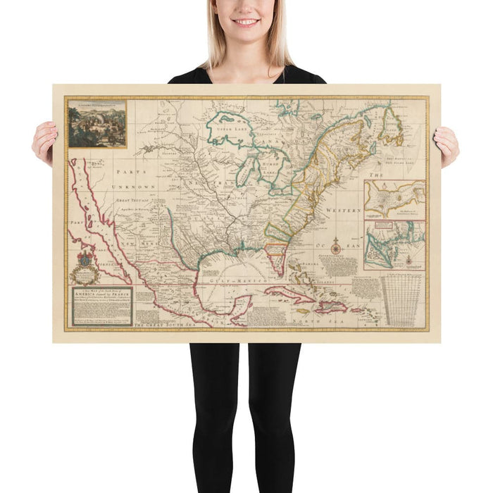
This masterpiece map of North America from 1720 was created by Herman Moll, the finest English cartographer and mapmaker of the 18th century.
This is one of the earliest and most detailed maps of the interior of North America. It was compiled at an intriguing point of history when most of the middle of the continent was called Louisiana or New France, and Mexico and the West Coast were claimed by Spain. The east coast, of course, was claimed by England!
One notable quirk of this map is that it shows the Margravate of Azilia, a proposed colony that was never created. A few years later it would become Georgia.
And of course, in 1720 we still thought California was an island - and the Pacific Northwest hadn't yet been discovered!
The map is politically interesting, too. Moll ardently declares that all lands east of the Mississippi belong to England rather than France - and he has carved out part of Florida to give back to Spain, too.
This map looks great at all sizes from 12x18 inches (30x40cm) to 18x24 inches (45x60cm) and beyond. The text is definitely quite small when printed at 12x18 inches. The map looks its best when printed large. I can create beautiful, large prints of this map up to 100 inches (250cm) wide. Please get in touch if you're looking for larger, customised or different framing options.
This map would make a great birthday or Christmas gift for someone from North America, or perhaps someone interested in the history and ethnography of the continent.
You can order the map itself, or you can order a framed version. The frame is a nice, simple black frame that really makes our maps pop out when on a wall. Please get in touch if you'd like a different frame, or if you'd like to frame one of the larger maps. We use super-clear acrylic (perspex/acrylite) in our frames - it's less reflective than glass and better for transport.
Share